GRAND RAPIDS, Mich. — Did you cave and turn on the A/C yet? With it feeling more like late July, that would be completely understandable.
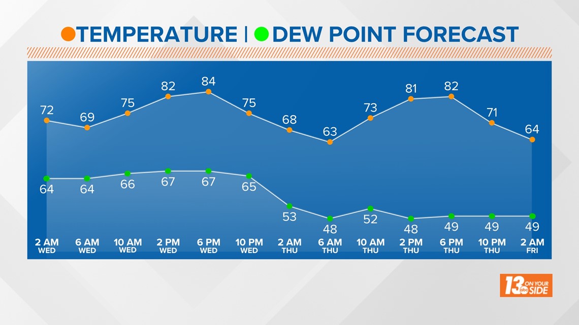
Today will be the hottest of the 10-day period. Feeling extra steamy due to our humid conditions. Temperatures this afternoon will top out in the mid to upper 80s with dew points in the 60s. This summer-like air could easily set off isolated thunderstorms. This evening's isolated thunderstorms are not expected to be severe but could contain heavy rainfall and lightning.
A break from the humidity comes as soon as tomorrow morning. Tonight's dewpoints drop into the upper 40s to low 50s, bringing back comfortable conditions. This comes as temperatures fall into the low 60s.


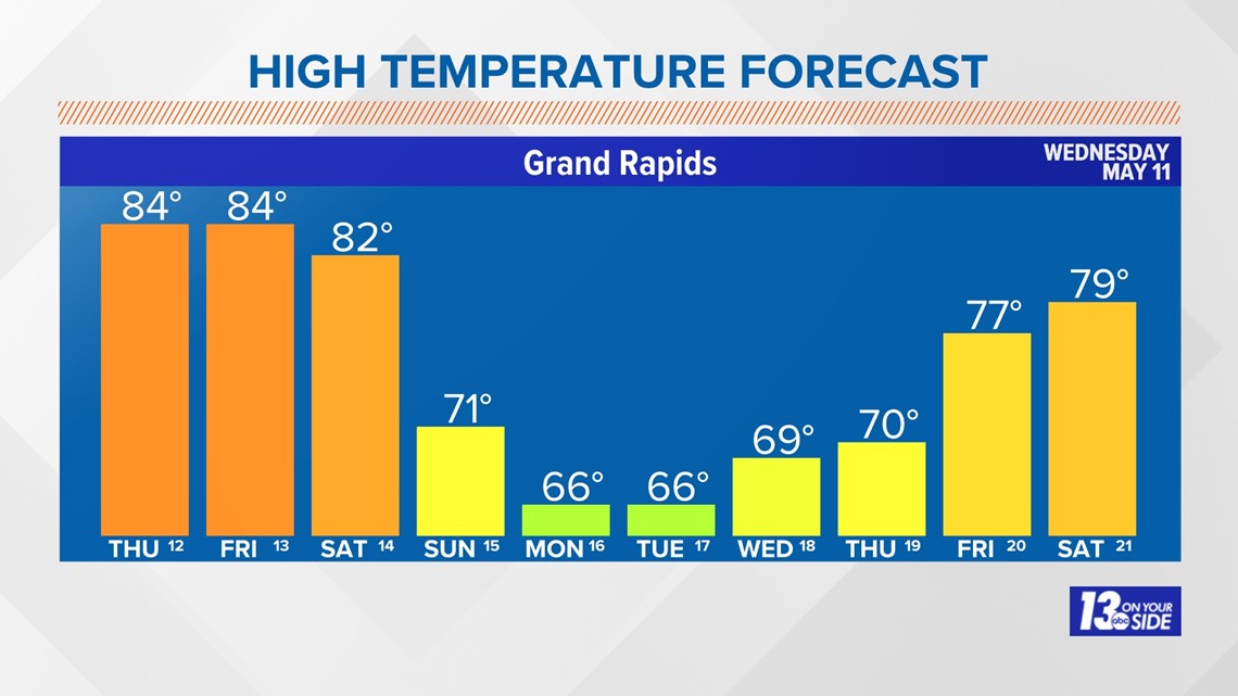
While we get a break from the humidity Thursday it will still be rather warm. Thursday's high sits around 84° with partly cloudy to mostly sunny skies. Sunshine continues on Friday with a high of 84°. Although, dewpoints will climb back into the low 60s making it feel humid again. The humidity and 80-degree temperatures stick around through Saturday afternoon with possible showers and thunderstorms.


Our cool down comes Sunday following the rain. Sunday's highs will be in the low-70s with clearing skies. Sunshine continues into early next week with highs in the upper-60s. Returning us back to seasonal spring conditions.
6-10 Day Outlook
Mon. May 16 through Fri. May 20 calls for below average temperatures and below average precipitation. Average highs are around 70-71° with an average precipitation of 0.63".
8-14 Day Outlook
Wed. May 18 through Tue. May 24 calls for below average temperatures and above average precipitation. Average highs are around 71-73° with an average precipitation of 0.92".
Have a 30-second video or still photo to share? We'd love to share it with everyone! Email your image to Weather@13OnYourSide.com or post it to our 13OnYourSide Facebook Page
►Make it easy to keep up to date with more stories like this. Download the 13 ON YOUR SIDE app now.
Have a news tip? Email news@13onyourside.com, visit our Facebook page or Twitter. Subscribe to our YouTube channel.


