GRAND RAPIDS, Mich. — If you think thunderstorms in West Michigan seem more frequent now than in years past, it's not just a feeling. The data is supporting that conclusion, as well.
According to an analysis of data from the National Oceanic and Atmospheric Administration (NOAA) done by Climate Central, the areas of the country most likely to see thunderstorms has been changing since 1979 and that includes a rise in the likelihood here in West Michigan.
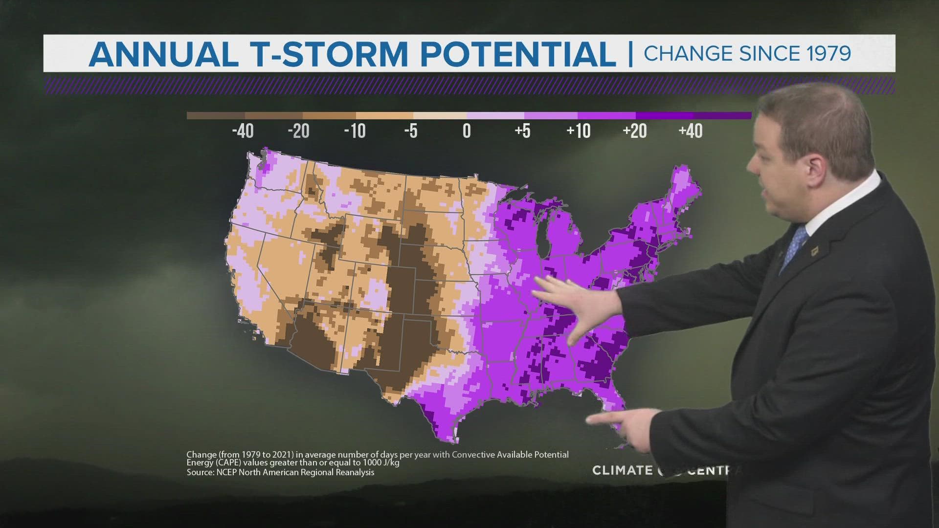
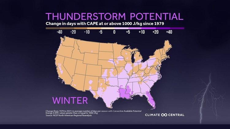
The study examined something called CAPE, or convective available potential energy, to determine what areas saw a rise or a fall in thunderstorm likelihood. CAPE is a measure of instability in the atmosphere, with higher values of CAPE being related to higher thunderstorm potential.
The map below shows the change in days with CAPE values over 1,000 J/kg, identified as a critical value for thunderstorm potential, since 1979.

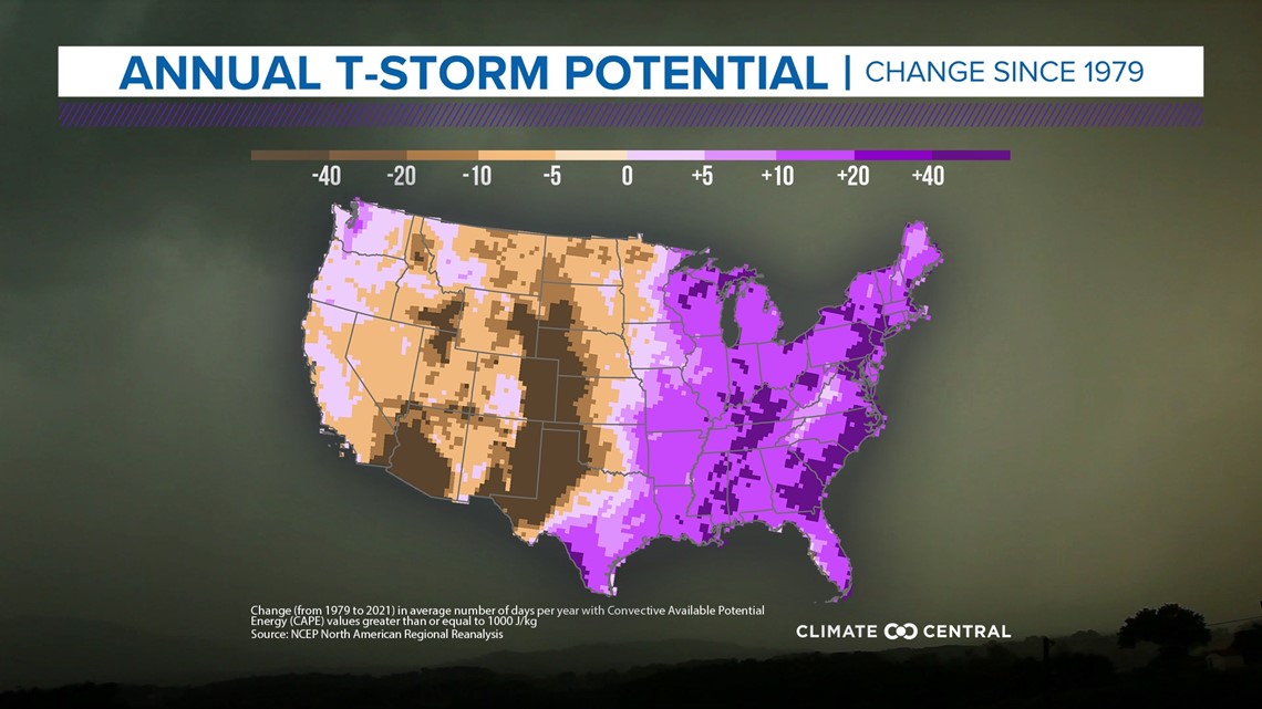
So, what has changed since the 1970s? Primarily, warming temperatures across the U.S.
These rising temperatures can be associated with both the lack of thunderstorms out west and the increase in thunderstorms to the east. Temperatures in the west have generally been warming as drought conditions have become more likely and sustained. Out east, we are seeing warming, but still moist conditions, which results in a higher level of instability in our atmosphere and better chances for thunderstorms.
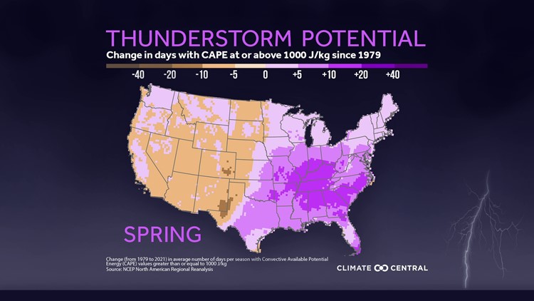
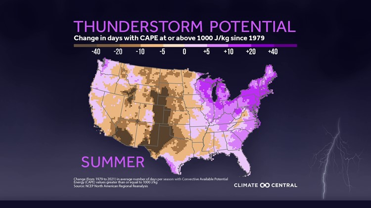
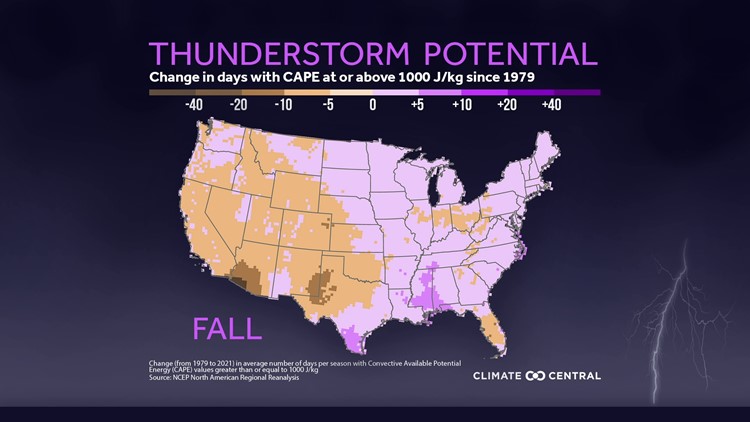
In West Michigan, we have seen modest increases in thunderstorm potential for the spring and the fall, but our largest rise has been during the summer. This goes hand in hand with summers that have seen rising temperatures, as well.
A breakout of change in thunderstorm potential by season is in the gallery below.
U.S. Change in Thunderstorm Potential by Season
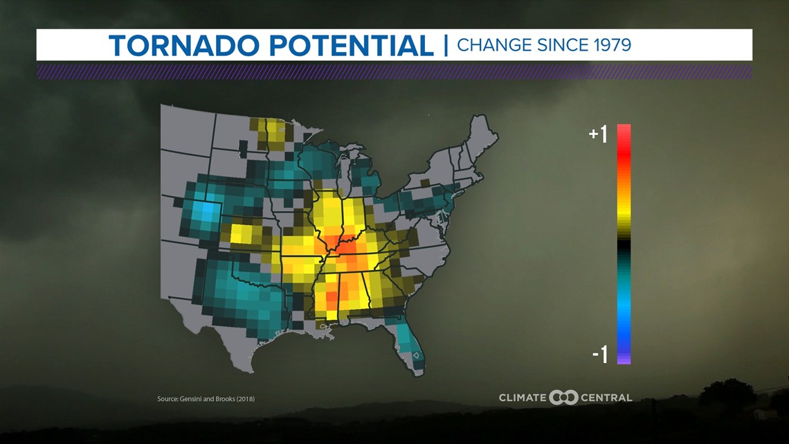
Of course, this rise in thunderstorm potential comes with a rise in the potential for severe weather, as well. Since 1979, the area of the country seeing the most tornadoes has also moved east along with the thunderstorm potential.
Below, you can see how tornado occurrences have shifted further east since the 1970s.

As we head into another summer that is forecast to be warmer than average, the meteorologists at 13 On Your Side will be keeping a close eye on any thunderstorms that make it to our neck of the woods. You can too by making sure to download the 13 On Your Side News and Weather apps for the latest radar and weather alerts!
-- Meteorologist Michael Behrens
Follow me on social media! Facebook Meteorologist Michael Behrens, Twitter @MikeBehrensWX, and Instagram @MikeBehrensWX.
Email me at: MBehrens@13OnYourSide.com
Have a 30-second video or still photo to share? We'd love to share it with everyone! Email your image to Weather@13OnYourSide.com or post it to our 13OnYourSide Facebook Page.
►Make it easy to keep up to date with more stories like this. Download the 13 ON YOUR SIDE app now.
Have a news tip? Email news@13onyourside.com, visit our Facebook page or Twitter. Subscribe to our YouTube channel.

