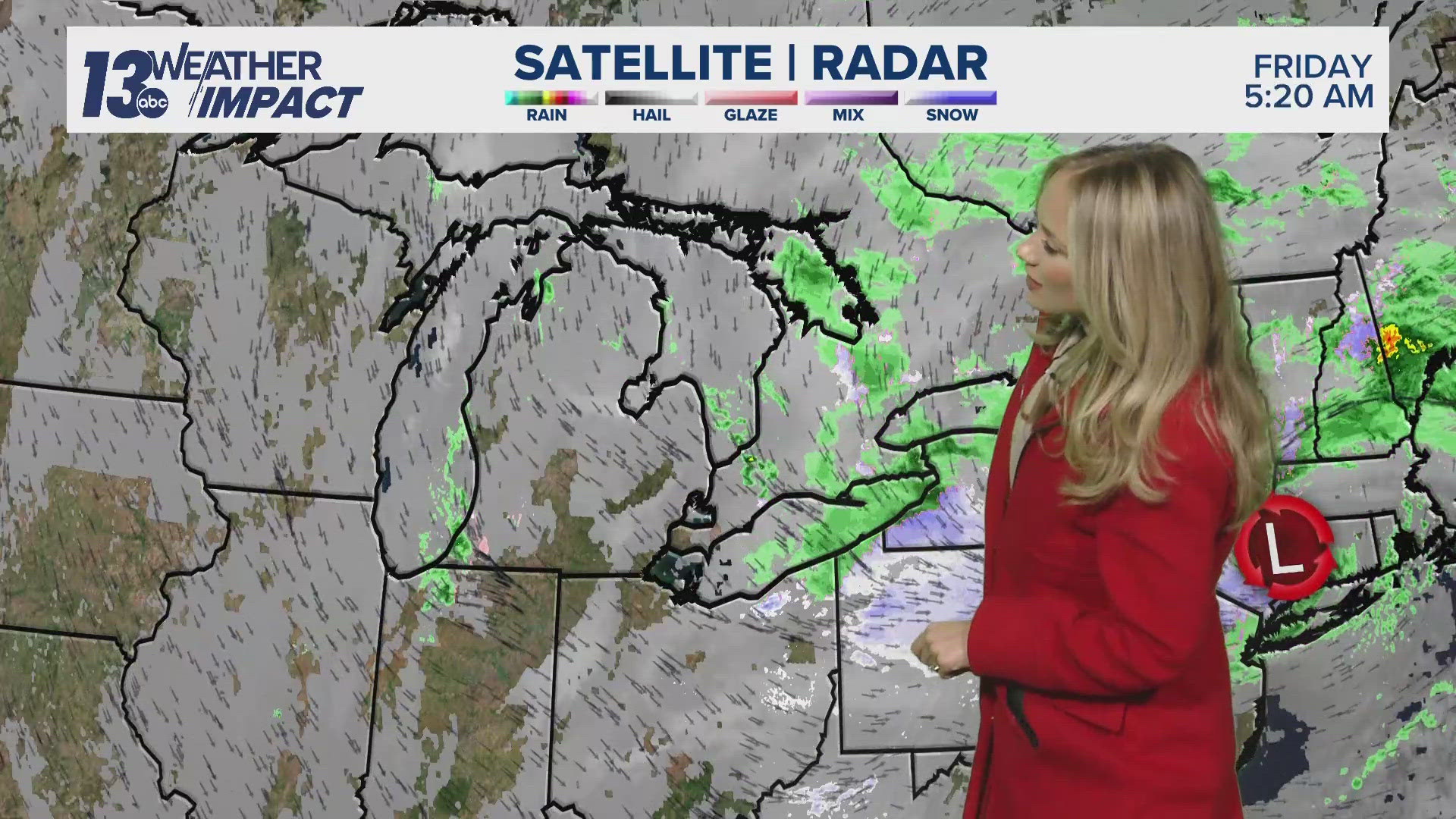
MICHIGAN, USA — LIVE UPDATES:
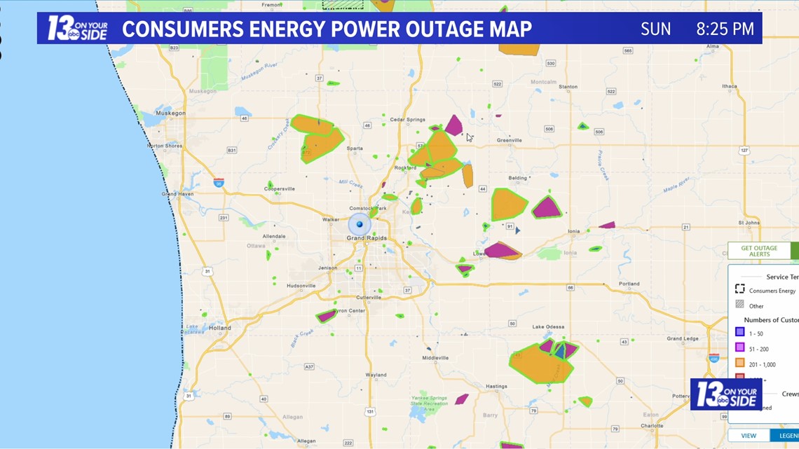
8:00 pm: The severe weather threat in West Michigan has ended. Power outages remain around the region, as clean up begins from downed tree limbs and power lines caused by strong winds.

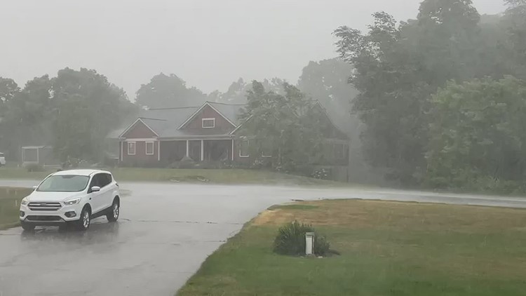
5:45 pm: Severe storms are continuing at this hour, but are starting to push out of West Michigan. Stay weather aware!
4:33 pm: A severe thunderstorm warning will remain over portions of West Michigan until 5:15 p.m. Residents can expect damaging winds and penny-sized hail.
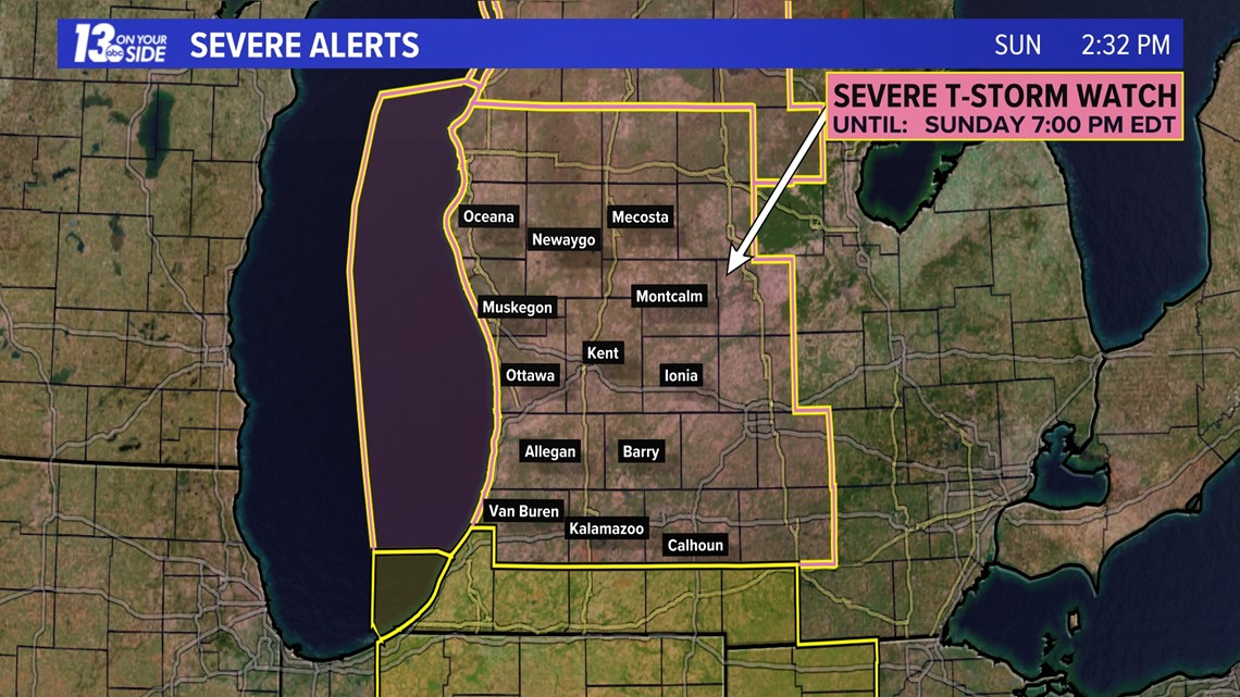
2:36 pm: As of this time a severe thunderstorm watch has been issued for all of West Michigan until 7 p.m. tonight. As of 2:36 p.m. storms were mostly over Lake Michigan and beginning to push onshore in Berrien County.
Storms will continue to push onshore this afternoon, likely strengthening as they encounter very warm and moist air over West Michigan. The highest risk for severe weather will be damaging winds, followed by hail, and a spin up tornado or two that cannot be ruled out.
Stay with 13 On Your Side all afternoon for the latest alerts and be sure to stay weather aware!

****Original story below (06/25/2023 @ 10:30 a.m.)****
It's important to remain 'Weather Aware' throughout Sunday, with the likelihood of thunderstorms and the possibility of a few becoming strong to severe.
A low pressure system out to the west will be moving into West Michigan throughout Sunday, bringing increased moisture and instability. This is creating the risk for strong storms.
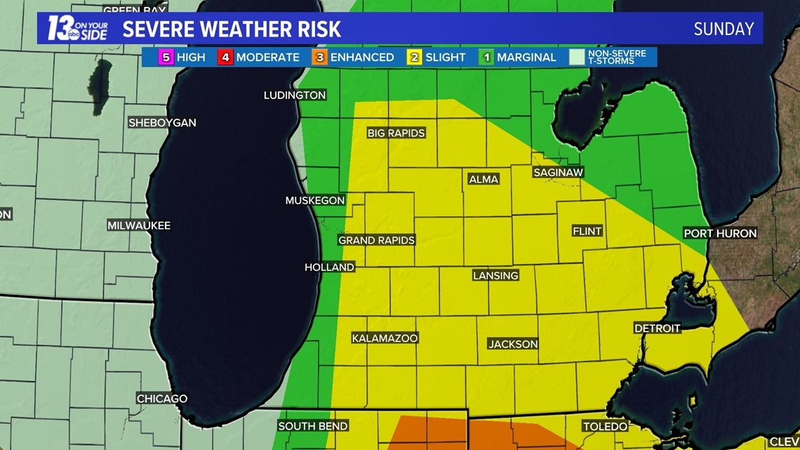
RISK:
Much of West Michigan has been upgraded to a 'Slight Risk' for severe weather (two on a scale out of five). This includes locations that are near and eastward of US-131 - Big Rapids, Grand Rapids, Ionia, Hastings, Kalamazoo and Battle Creek for reference.
Lakeshore communities remain in a 'Marginal Risk' (one out of five). While a lesser threat, severe weather is still possible.

TIMING:
Thunderstorms will likely blossom over the eastern half of Lake Michigan in the early afternoon, then progress inland through early evening.
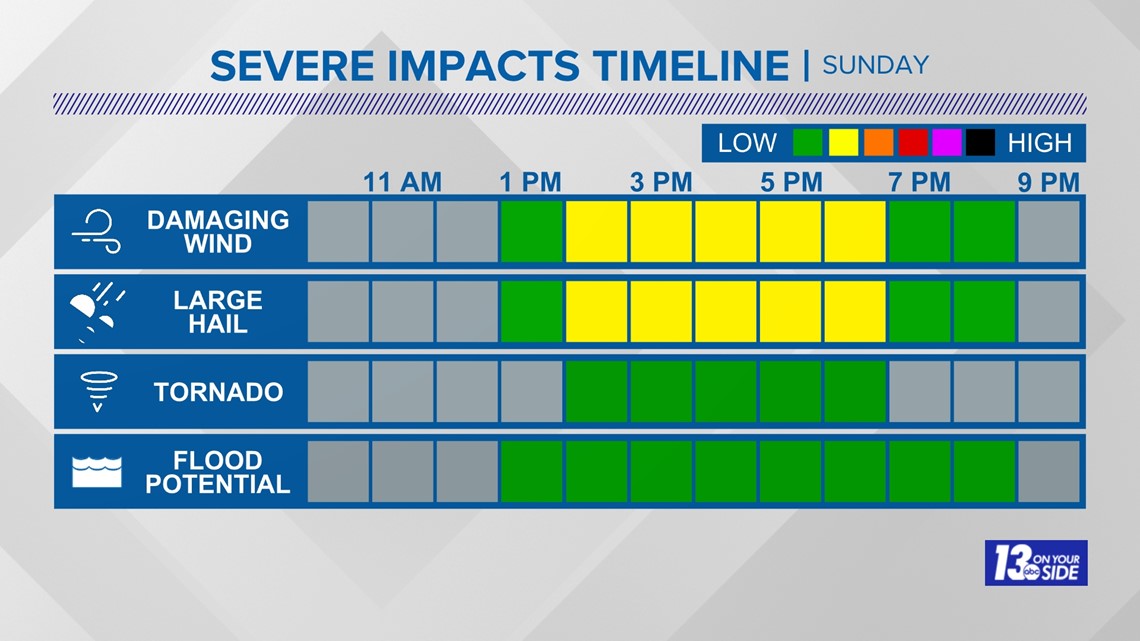
Timewise, thunderstorms will be possible between 12 p.m. and 8 p.m., with the likeliest severe weather risk between 2 p.m. and 6 p.m.
HAZARDS:
The main risks associated with this system will be gusty to damaging winds, large hail, and heavy rain. Tornado risk is the lowest risk, but not zero, especially southward of I-96 (brief, spin-up tornado is possible).

FURTHER AHEAD:
The opportunity for thunderstorms will end overnight, but on and off showers will continue through Monday. It'll remain humid into Monday, but daytime temperatures will only settle in the lower 70s.
Make sure to stick with 13 On Your Side throughout the day on Sunday for the latest storm updates and weather alerts! Stay weather aware West Michigan!
►Make it easy to keep up to date with more stories like this. Download the 13 ON YOUR SIDE app now.
Have a news tip? Email news@13onyourside.com, visit our Facebook page or Twitter. Subscribe to our YouTube channel.