GRAND RAPIDS, Mich. — With severe weather season on the way to West Michigan, it's important to take some time and make sure that you are prepared for the storms. Part of that preparedness is making sure that you understand what different severe weather alerts actually mean.
While most people have a general idea of what a severe thunderstorm is and what a tornado is, understanding what exactly each alert means can be a little more complex. That is because each alert actually comes with tags and information specific to the storm being alerted for.
This means one warning does not always mean the same thing as another, even within the same category.
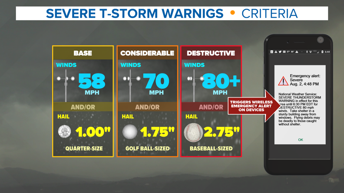
Inside the text of each warning you will find information about how strong the winds are for that storm, if they expect hail and to what size it is expected to be, and if a tornado may or may not be possible. At its most basic a severe thunderstorm warning will be issued for 58+ mph winds and or 1+ inch diameter hail.
A severe thunderstorm warning will be upgraded to "Considerable" if there is 70+ mph winds or golf ball size or larger hail. That warning will be further upgraded to "Destructive" if winds of 80+ mph are expected or baseball size or larger hail. Destructive category warnings will also send a wireless emergency alert to your phone.


A severe thunderstorm warning may also contain the tag "tornado possible". What this means is that a forecaster with the National Weather Service does not have enough evidence to issue a tornado warning, but feels this storm could quickly produce a tornado at any time. These types of alerts should be treated like tornado warnings and you should seek shelter until the storm passes.
Tornado warnings also have categories, including radar observed, observed in person, considerable damage potential, and Tornado Emergency/catastrophic damage potential. While the higher end categories represent a major threat to life and property, all tornado warnings should be taken seriously.
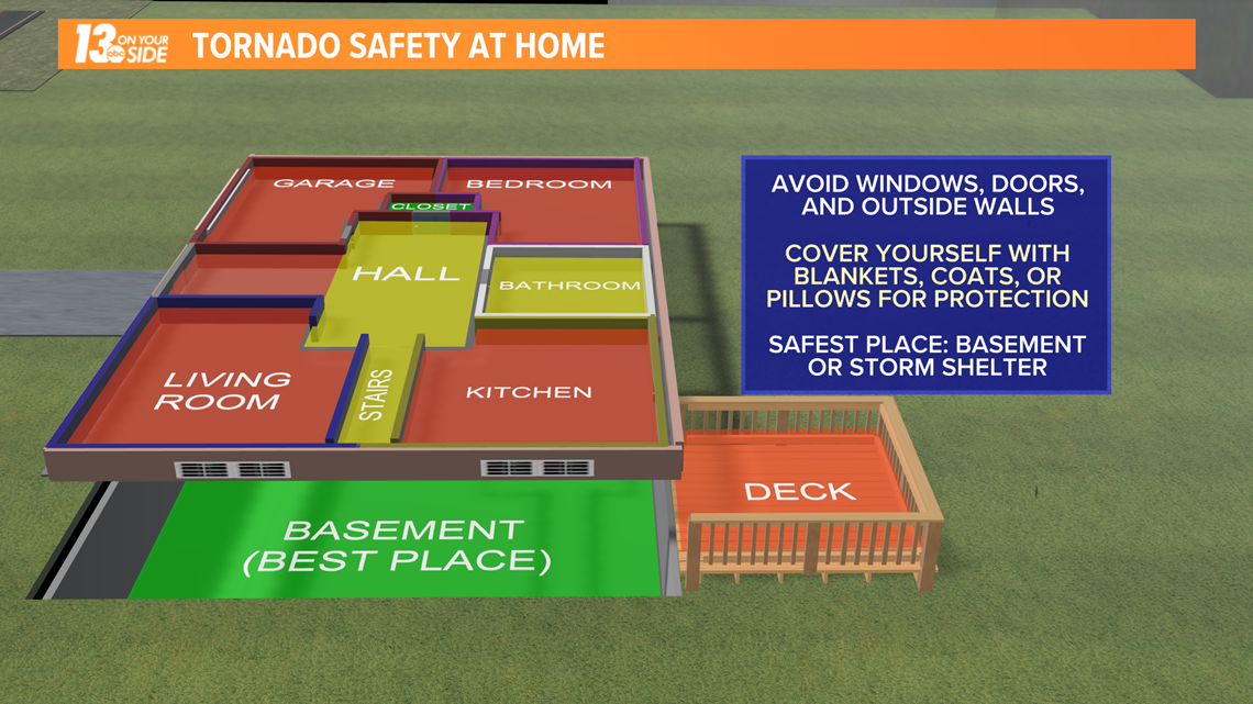
Make sure you seek appropriate shelter in the event any tornado warnings are issued.


Digging through severe weather alerts and finding this information on your own when storms are on the way can be a challenging task. That's where you want a trusted partner, like the 13 On Your Side Weather Team, to be with you to explain what each alert means and the threats involved.
You can always trust that our team will be here for you, on-air, online, and on our mobile app/streaming on social media whenever storms are impacting West Michigan. We will be here to keep you informed every step of the way!
-- Meteorologist Michael Behrens
Follow me on social media! Facebook Meteorologist Michael Behrens, Twitter @MikeBehrensWX, and Instagram @MikeBehrensWX.
Email me at: MBehrens@13OnYourSide.com
Have a 30-second video or still photo to share? We'd love to share it with everyone! Email your image to Weather@13OnYourSide.com or post it to our 13OnYourSide Facebook Page.
►Make it easy to keep up to date with more stories like this. Download the 13 ON YOUR SIDE app now.
Have a news tip? Email news@13onyourside.com, visit our Facebook page or Twitter. Subscribe to our YouTube channel.

