GRAND RAPIDS, Mich. — When it comes to winter and snowfall in West Michigan it is hard to get too much further without thinking about cold temperatures as well. However, a warming climate and warmer average temperatures could actually have the opposite effect of what you might think.
RELATED: Is Every Snowflake Truly Unique?
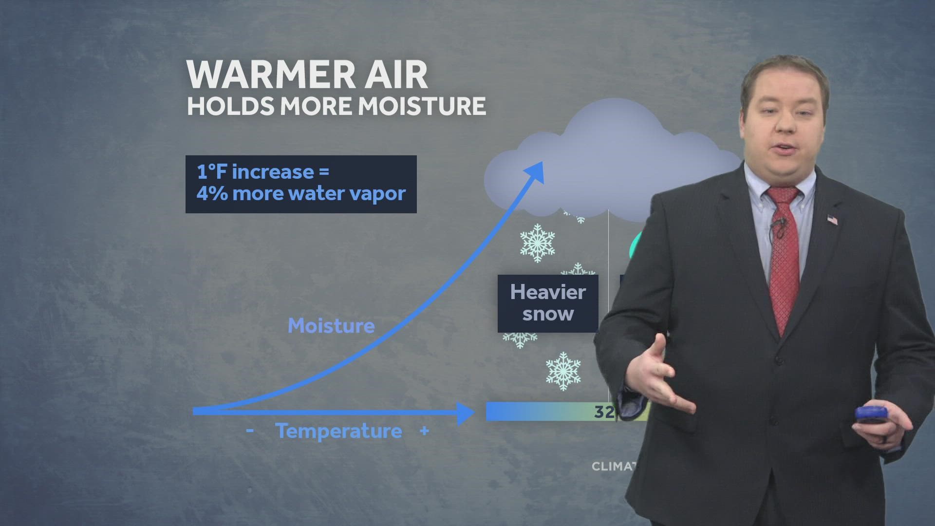
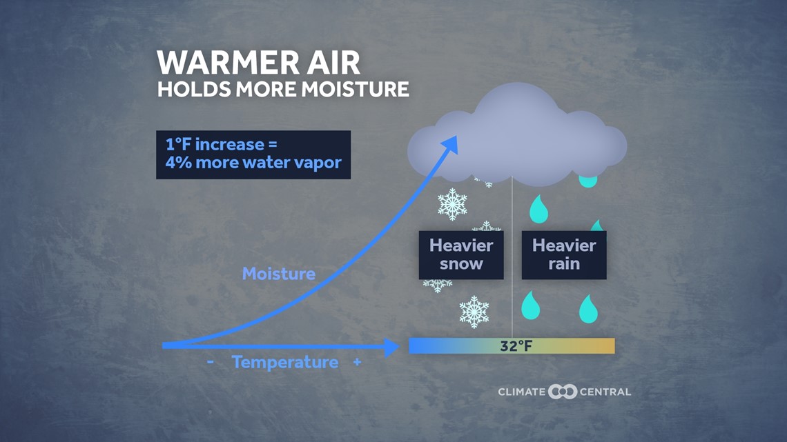
Believe it or not, a warmer environment can actually lead to heavier amounts of snowfall and heavier types of snowfall when it does come down. This is because when the air is warmer it can physically hold more moisture and can lead to heavier snowfall rates and a wetter/physically heavier snow to fall.

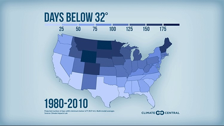
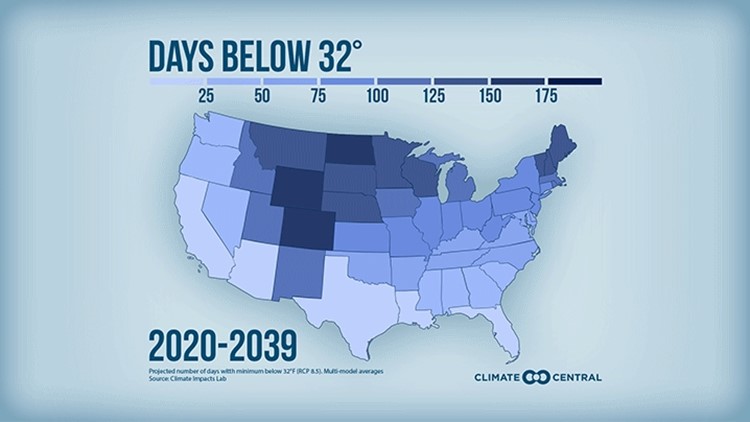
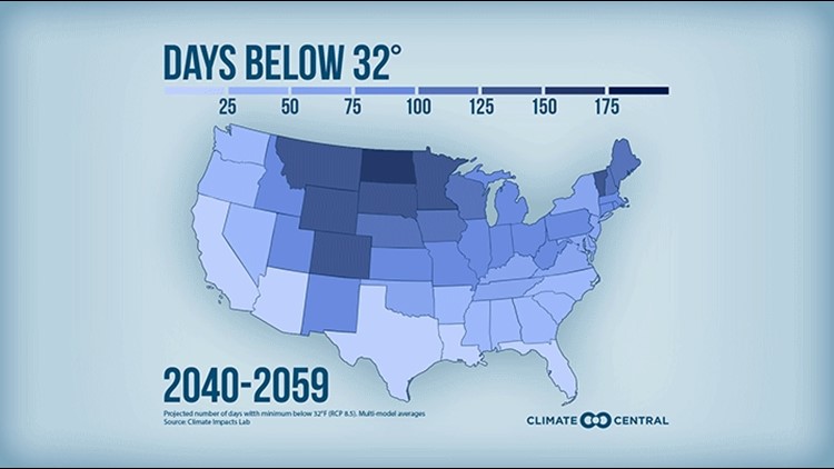
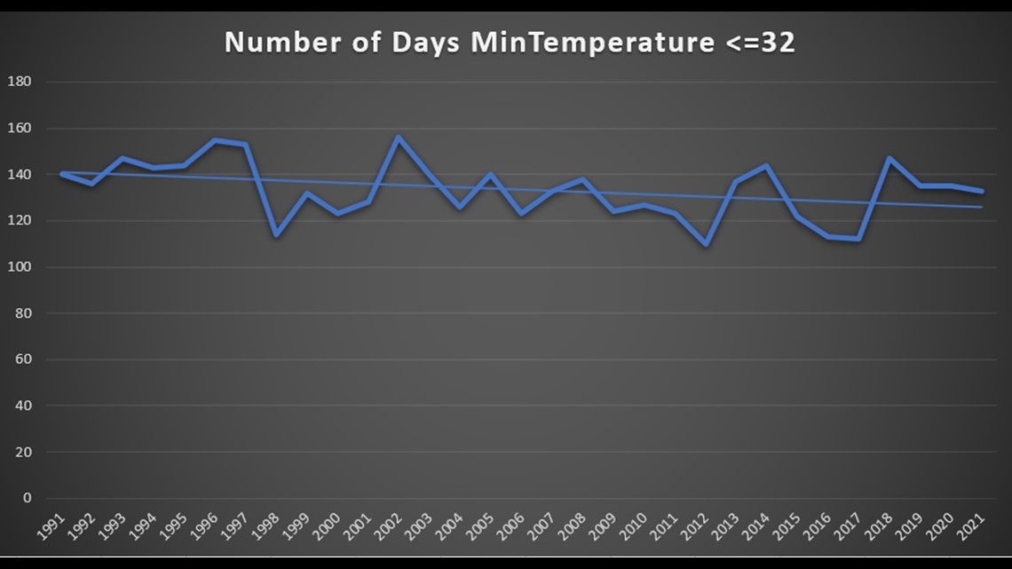
When it comes to our temperatures, we have seen a noticeable downward trend in days where temperatures fall below the freezing mark in the last 30 years. This demonstrates how our years are warming on average as of recent history, which could result in more of these heavy/wet snowfall events in the years ahead.

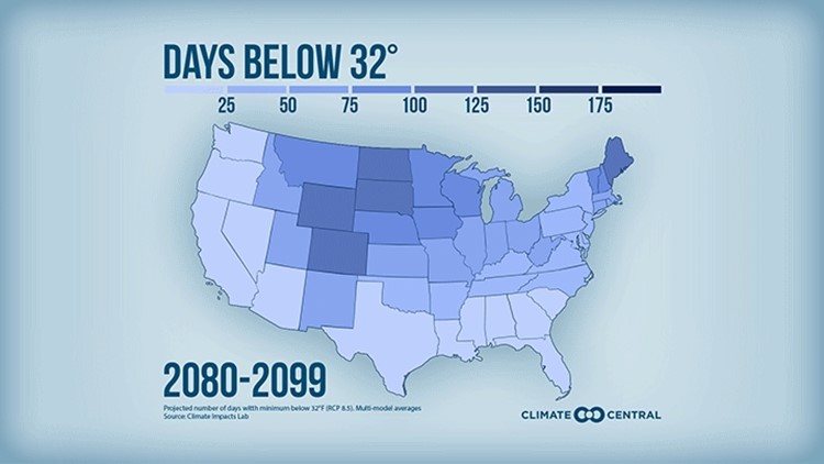
If these trends continue at their current rate, we could be looking at a drastically different winter by the end of the century. The images below from Climate Central show how this may play out over time.
Below Freezing Days Forecast Through 2099
In addition to simply allowing air to hold more moisture, snowfall in winter for West Michigan can be increased for another factor by warmer temperatures, that factor is our lake-effect snowfall.
Warmer winters mean Lake Michigan will be less likely to freeze up enough for lake-effect snow to stop forming by the end of the winter season. This means all months of winter could be impacted by heavy accumulations of lake-effect snow, even ones that traditionally would not previously see this snow.
The trend for the last almost 50 years shows this pattern already playing out, as overall ice coverage on Lake Michigan continues to trend downward.


With heavier winter snows a possibility in our changing climate, making sure you stay prepared is essential. The 13 On Your Side Weather Team will keep you informed each and every winter, regardless of how snowy things can get!
-- Meteorologist Michael Behrens
Follow me on social media! Facebook Meteorologist Michael Behrens, Twitter @MikeBehrensWX, and Instagram @MikeBehrensWX.
Email me at: MBehrens@13OnYourSide.com
Have a 30-second video or still photo to share? We'd love to share it with everyone! Email your image to Weather@13OnYourSide.com or post it to our 13OnYourSide Facebook Page.
►Make it easy to keep up to date with more stories like this. Download the 13 ON YOUR SIDE app now.
Have a news tip? Email news@13onyourside.com, visit our Facebook page or Twitter. Subscribe to our YouTube channel.

