GRAND RAPIDS, Michigan — Welcome back, Old Man Winter! Meaningful lake effect snow will return to a portion of West Michigan by the end of the week as a colder-than-average weather pattern settles across the Great Lakes region. With the likelihood of accumulating snow and travel impacts, a 13 Weather Impact Alert has been issued for Friday and Saturday.
NOW THROUGH THANKSGIVING DAY
Travel impacts will remain little to none through Thanksgiving Day. A low-pressure system will slide across the Ohio River Valley late Wednesday into early Thursday (Thanksgiving), with precipitation remaining well southward of West Michigan.
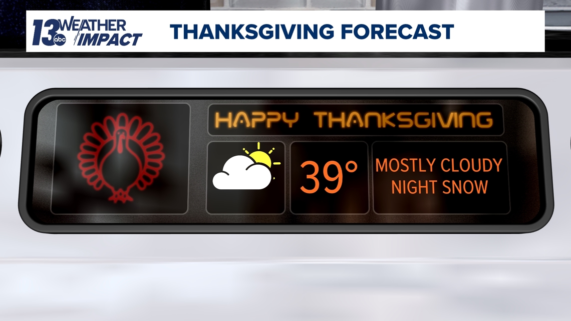
Thanksgiving Day will be chilly as daytime temperatures only reach the upper 30s, which is below average for late November. Outside of a few afternoon flurries, the daytime hours are expected to remain dry. Increasing coverage of lake effect snow will become realized in the evening to nighttime hours.

LAKE EFFECT SNOW – WHEN & WHERE
A favorable lake effect pattern will arrive Thursday night, continue throughout Friday, and linger on Saturday across West Michigan. Temperatures will continue to tumble as a colder air mass settles over the Great Lakes, allowing for plentiful over-lake instability and resultant lake effect snow.

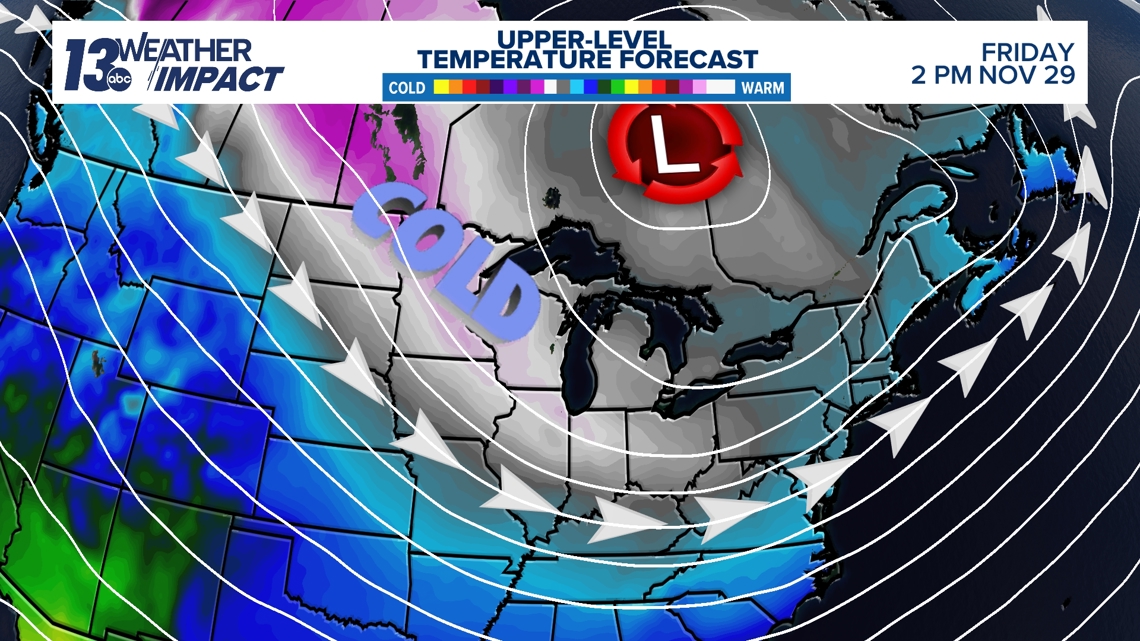
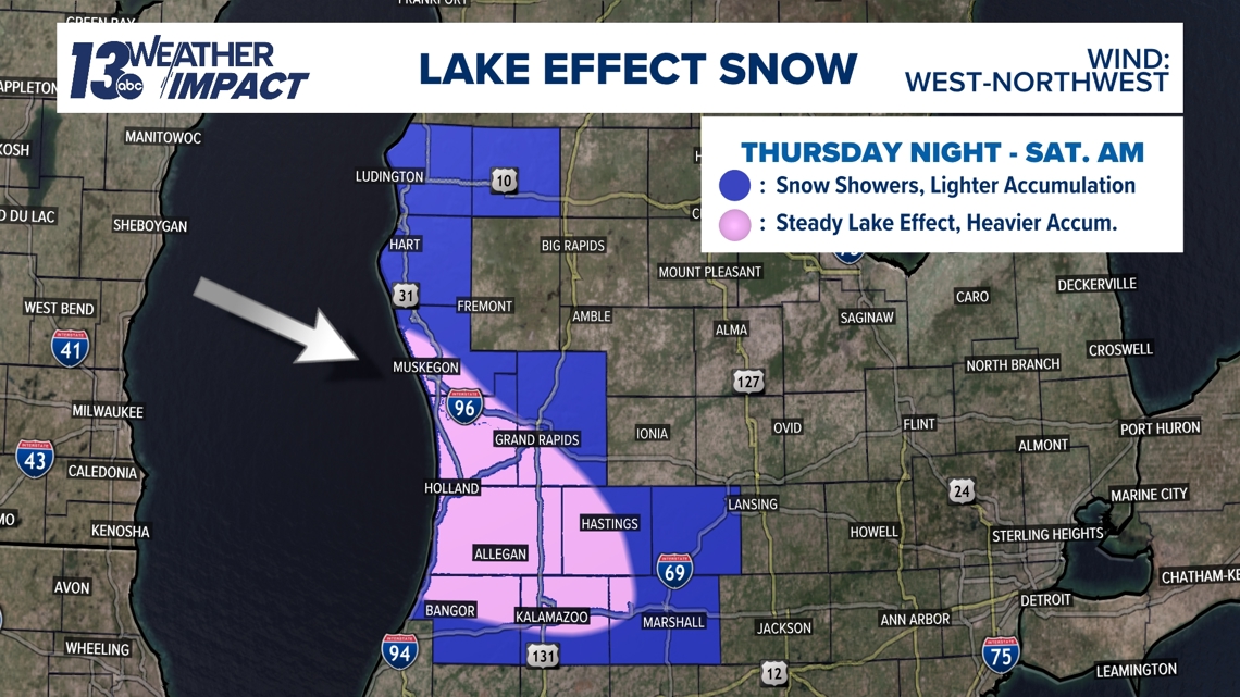
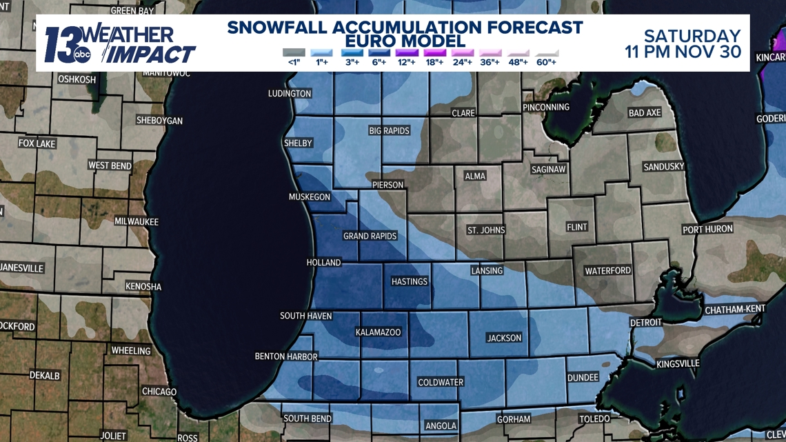
Confidence is increasing that the wind direction will be primarily out of the west-northwest late Thursday through early Saturday. A W-NW wind setup would result in the heaviest snowfall and highest impacts to develop south and west of Grand Rapids – favoring southwest Kent Co. and the entirety of Ottawa, Allegan, Barry, Van Buren, and Kalamazoo County. It should be noted that all immediate lakeshore communities – including parts of Muskegon, Oceana, and Mason Co. – will contend with accumulating snow and travel impacts.
Lesser accumulation and resultant impacts are expected north and east of Grand Rapids, including northeast Kent Co. and much of Ionia, Montcalm, Mecosta and Newaygo counties.

IMPACTS
It’s becoming increasingly likely that several inches of lake effect snow will accumulate overnight Thursday through Saturday morning, with the widespread potential of 3”+ and localized potential of 6”+ in the heaviest snow bands. This’ll be plenty to shovel and/or plow.

Travel impacts are expected, as the timing of the lake effect snow coincides with the holiday weekend. Those who are planning to participate in Black Friday shopping should be prepared for low visibility and snow-covered roads, especially in the heaviest lake effect bands. While lake effect snow will wane Saturday, slick spots will remain as temperatures stay below freezing. If you or family/friends plan on traveling across Michigan, the typical snow belts of N. Lower Michigan and the Upper Peninsula will also contend with lake effect snow and travel impacts late Thursday through the weekend.
Temperatures will be colder than average all across West Michigan, with daytime temperatures only reaching the lower 30s Friday and Saturday, and upper 20s Sunday. This will diminish the influence of the 'warmer' ground that was present with the first snowfall of the season last week.

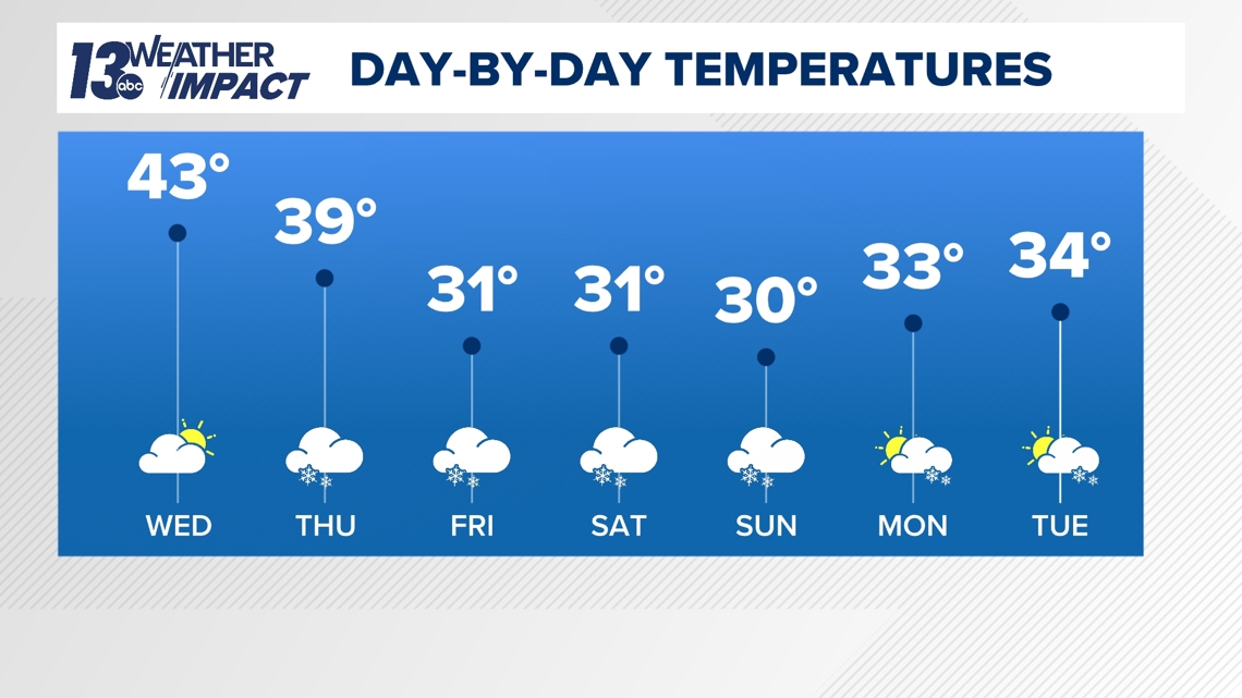
Another round of lake effect snow is appearing likely Sunday into Monday, with the potential of system snow further into next week. Below-average temperatures are expected to last through the entirety of next week.
NEED
It's the time to make sure the snow blower, snow plow, and anything else you use to clear snow is up and running. Continue to check in throughout the week as fine details are resolved with the atmospheric setup. We'll let you know if any weather alerts are issued by the National Weather Service as the week goes on.

Have a 30-second video or photo to share? We'd love to share it with everyone! Share your images by texting your name and location to 616.559.1310 or email to Weather@13OnYourSide.com or post it to our 13OnYourSide Facebook Page

