
MICHIGAN, USA — West Michigan's first widespread snowfall of the season made its presence known Tuesday into Wednesday, spreading a slippery and slushy mess.
Thousands of West Michiganders woke up without power Wednesday after a winter system moved through the region Tuesday and overnight.
Crews are working to restore power, and first responders are also tending to numerous slide-offs and fender benders. You can check out the latest traffic conditions here.
How much snow did your area get?
Below are our snowfall totals as of 11:30 a.m. Wednesday.
SNOWFALL TOTALS

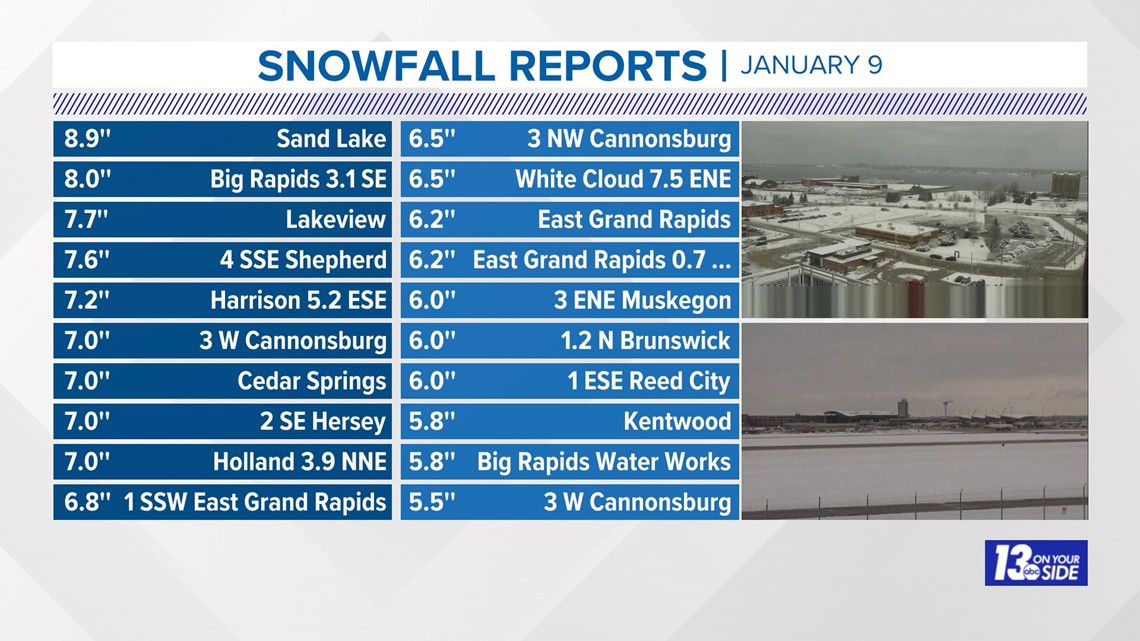
Talk about ideal packing snow. There was a fair amount of 6”+ reports, especially near and to the north and east of I-96.
Grand Rapids has measured 5.4” of snow from Tuesday into early Wednesday. Beforehand, Grand Rapids had only recorded 3.5” for the entire season!
There is plenty more snow on the horizon.
- Wednesday Night - Thursday: The first round of quick-system snow arrives Wednesday night, lasting through Thursday. This is forecast to produce 1-2''+ amounts.
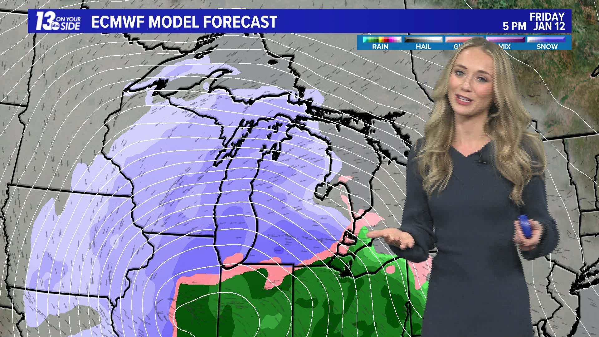
- Friday Afternoon - Saturday: The second round will be a high-impact snow event with wind gusts to 40+ mph along with heavy, wet snow. This is forecast to produce potential snow amounts up to 12''.
- Weekend: The third, and prolonged round of snow will be lake-effect snow, producing up to an additional 4"+ from Sunday morning through Monday morning. More snow accumulation is forecast throughout the week.
The snowstorm with the highest impact will be Friday afternoon through Saturday.
SHARE YOUR SNOW REPORTS!
A best practice is to measure in multiple locations.
Take measurements in several spots to account for variations in snow depth due to wind and other factors. Calculate the average of these measurements for a more representative snow depth (Add all your measurements up and divide by the number of measurements you took)
You can text 616-559-1310 to share your photos and reports with us.
►Make it easy to keep up to date with more stories like this. Download the 13 ON YOUR SIDE app now.
Have a news tip? Email news@13onyourside.com, visit our Facebook page or Twitter. Subscribe to our YouTube channel.
Watch 13 ON YOUR SIDE for free on Roku, Amazon Fire TV Stick, Apple TV and on your phone.