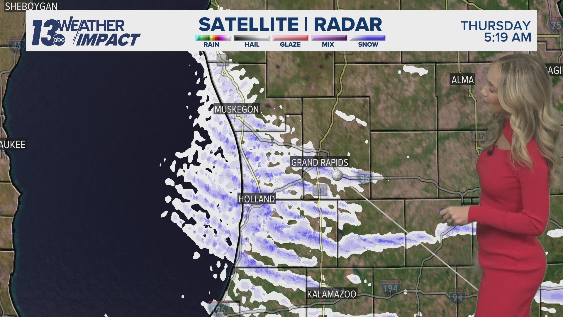
GRAND RAPIDS, Mich. — As of 8 a.m. Thursday, most counties neighboring lakeshore communities are no longer experiencing the brunt of the lake-effect snow. Instead, they can expect only light flurries for the remainder of the day.
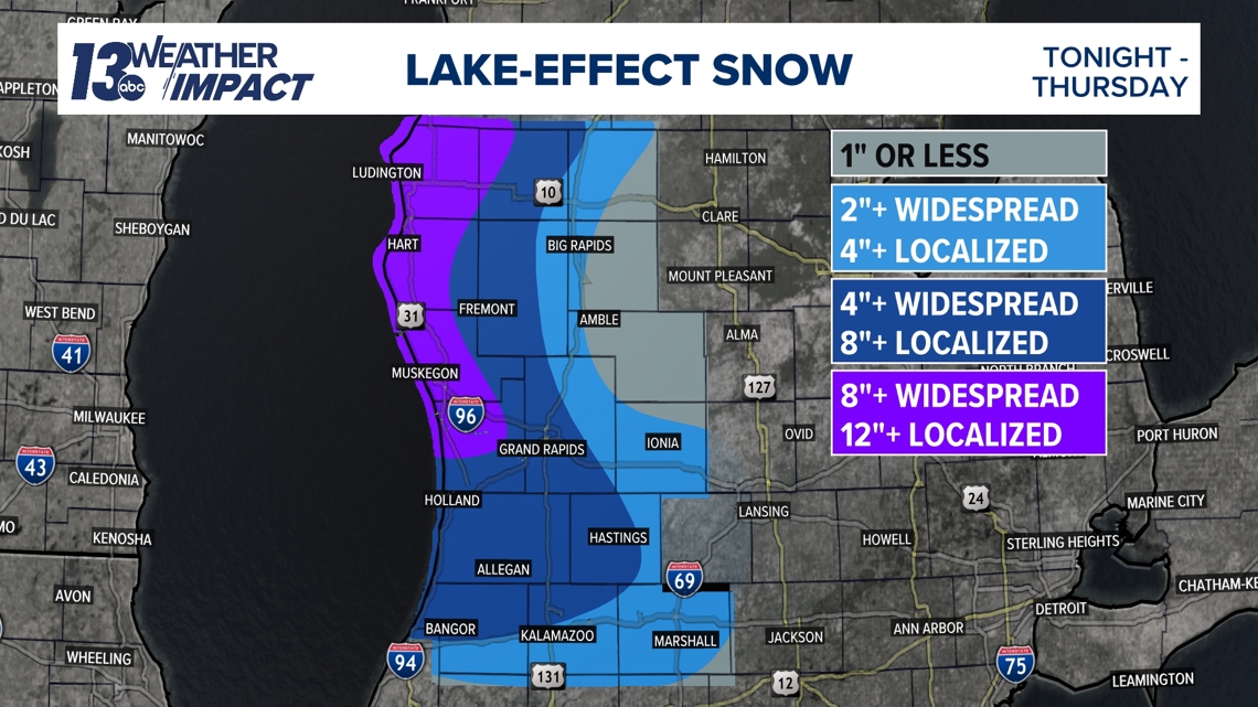
Yesterday’s cold front, combined with overnight and early morning lake-effect snow, aligned with our expectations for inland snowfall totals. The highest accumulations were concentrated in locally dense lake-effect snow bands. Below is an image of our 13 ON YOUR SIDE forecast snowfall totals leading up to this system:

Here are some of the snowfall reports so far:

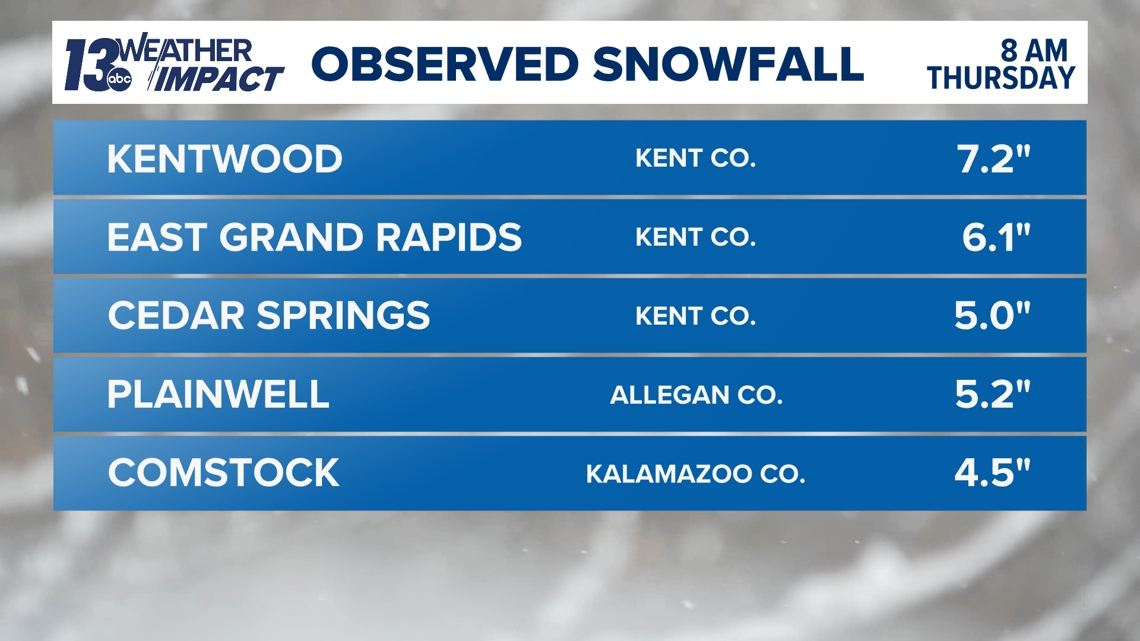

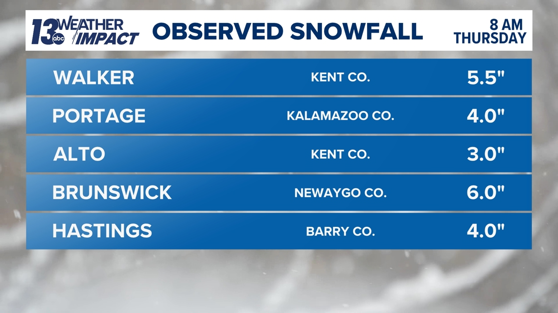

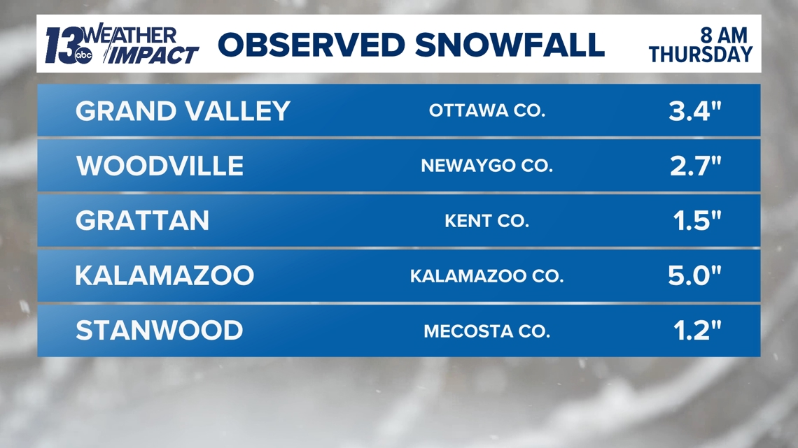
These reports align with our 13 ON YOUR SIDE forecast. Now, we’re awaiting more lakeshore reports to come in. The winds from the late evening into the overnight hours were strong enough to push the most intense bands well inland, resulting in our highest snowfall report of 7.2 inches, fitting nicely within our 4- to 8-inch forecast range for that area. Those in the 1- to 4-inch range also meet our forecast.
With several areas in Oceana and Mason counties receiving 7 to 9 inches of snow Tuesday night into Wednesday, plus an additional 1 to 3 inches last night, it appears we’ll also meet our snowfall totals for northern lakeshore counties. We’re still waiting on more data for Muskegon, Ottawa and Allegan counties, where blowing and drifting snow may lead to some delays in reported totals—plus it is still actively snowing. More information should be available in the afternoon.
While our forecasts aren’t always perfect, we hope this shows you that we have a great team of lake-effect snow forecasters who are constantly analyzing, refining and creating the best possible forecast for you.
If you have any additional snowfall reports, please text them to us at 616-559-1310.

