GRAND RAPIDS, Mich — It's time to reconsider your travel plans -- wicked weather is on its way to West Michigan this weekend.
Heavy rain, snow, ice and strong winds will combine to make travel hazardous Friday night through Saturday. Widespread power outages and flooding are possible as well.
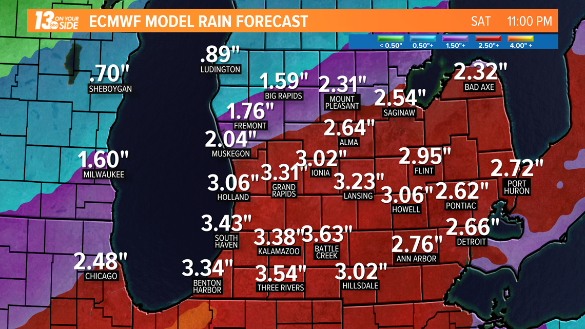
From Thursday evening through Friday afternoon, expect light rain showers and mild temperatures. By Friday night, soaking rains arrive while colder air edges in and winds increase. Communities may measure 2-3" of rain, leading to potential localized flooding. The highest rainfall totals will fall in the south and east of West Michigan.
►FORECAST: 13 On Your Side Forecast: Warming Up

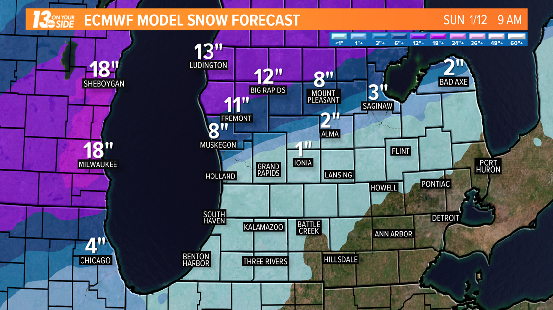
Heavy snow will fall north of Interstate-96 with up to a foot possible by Sunday morning. Those near I-96 will be on the cusp of the snow/rain line and may measure little snow to several inches.

With the rain/snow line setting up right over West Michigan, the potential for substantial ice accumulation is looking very likely. Sleet may mix in with freezing rain, which will cut down on ice buildup but result in slushy roads.

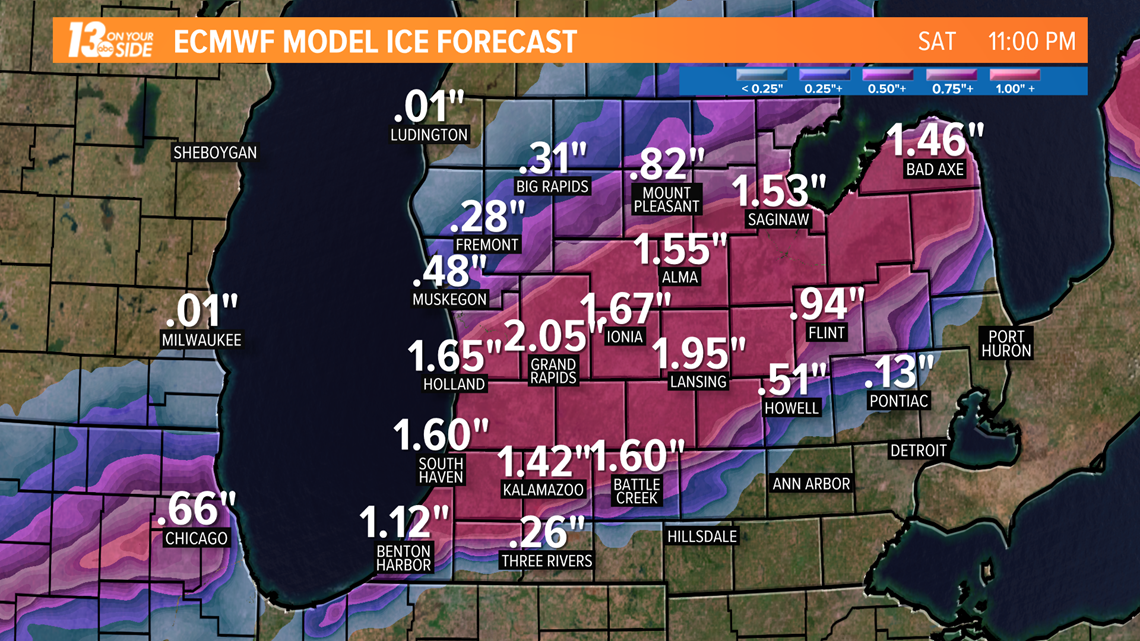
Winds will be gusty throughout the storm. Strong winds will increase the likelihood of power outages, especially if ice accumulates on trees and power lines.
By Sunday, only light snow remains. Showers will exit to the northeast in the morning.
RELATED VIDEO:
More Weather Stories on 13 ON YOUR SIDE:
►Make it easy to keep up to date with more stories like this. Download the 13 ON YOUR SIDE app now.
Have a news tip? Email news@13onyourside.com, visit our Facebook page or Twitter. Subscribe to our YouTube channel.

