
MICHIGAN, USA — Monday’s weather is a brief reminder that it’s December across West Michigan, and the lake effect is more representative of what we should expect this time of year.
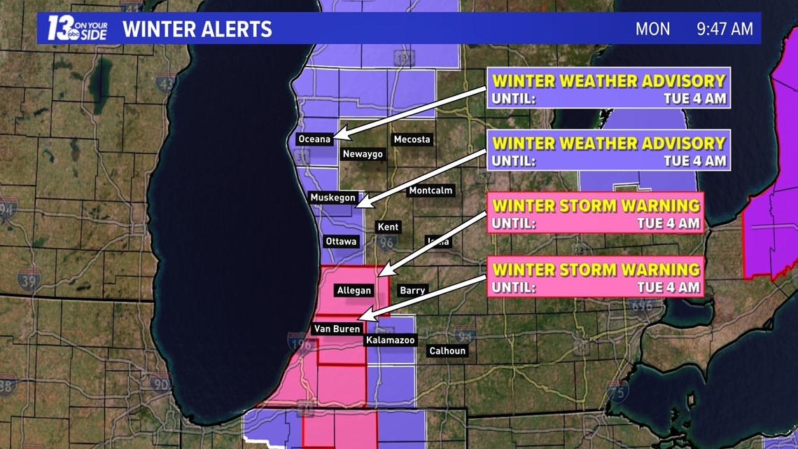
Winter Storm Warning is in effect for Allegan and Van Buren counties, with a Winter Weather Advisory in effect for Ottawa, Muskegon, Oceana, Kalamazoo counties. All headlines continue through Monday into the early hours of Tuesday.

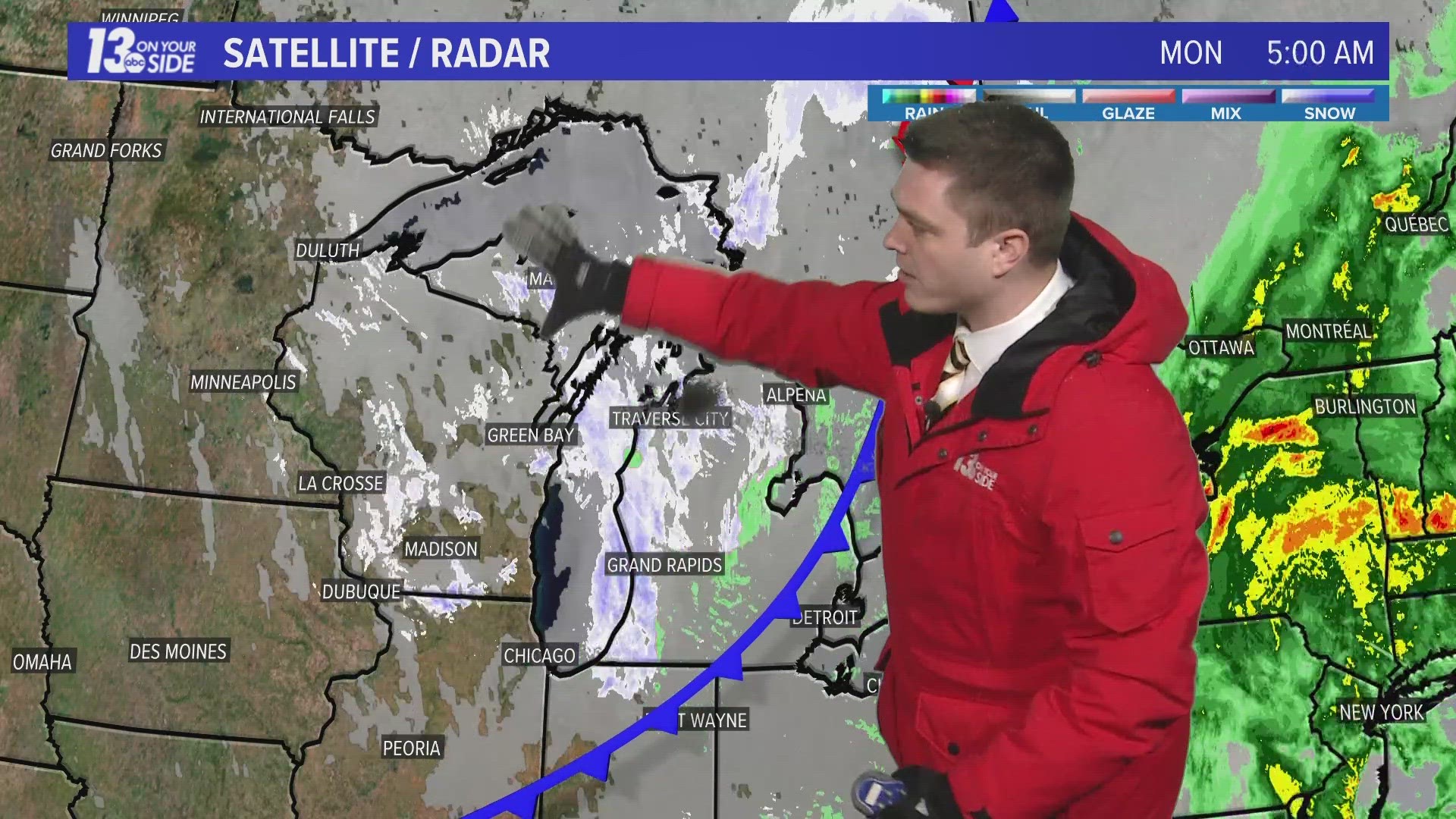
Bursts of snow will continue to be widespread this morning as a cold front/wave of energy passes through the Great Lakes. Commuters should watch out for slick, snow-covered conditions and varying visibility, potentially whiteout at times. Quick accumulation is expected, especially in locations that contend with the heavier bursts of snow.
Following the widespread morning snowfall, heavy and intense bands of lake-effect snow will set up as winds turn to the northwest. Impacts will be felt greatest near the lakeshore, especially south of Holland across Allegan and Van Buren counties, where the heaviest lake effect bands will set up. Another area of impact from these lake effect bands will be north and west of a Muskegon – Fremont – Big Rapids line. These bands of lake effect snow will continue through early Tuesday morning, before ending quickly by midday.

The combination of lake effect snow and winds gusting in excess of 40 mph will create localized hazardous travel conditions. Expect slow-going travel, with near whiteout conditions periodically, along US-31 north of Muskegon, along US-10, I-196 south of Holland, and I-94 west of Kalamazoo.
Below is the latest hour-by-hour forecast:
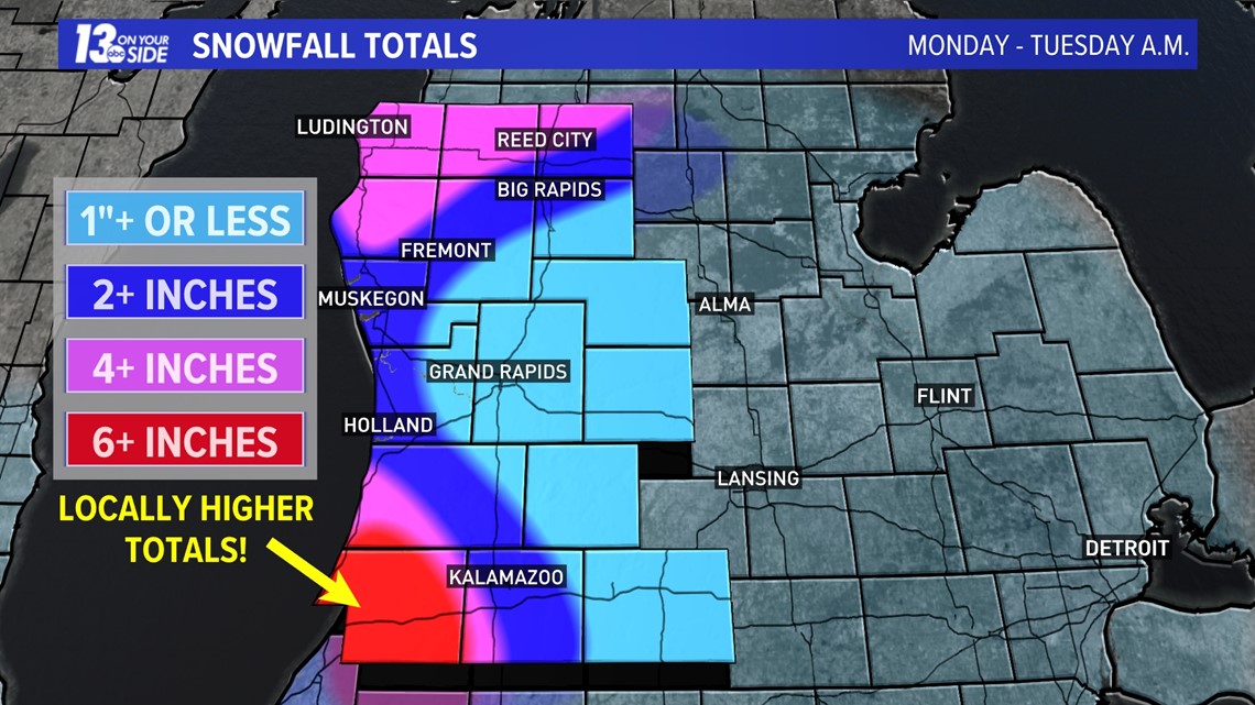
As typical for a lake effect snow event, accumulation will vary greatly and be location-dependent. Areas that contend with the heaviest lake effect bands are expected to exceed a half foot of snowfall.
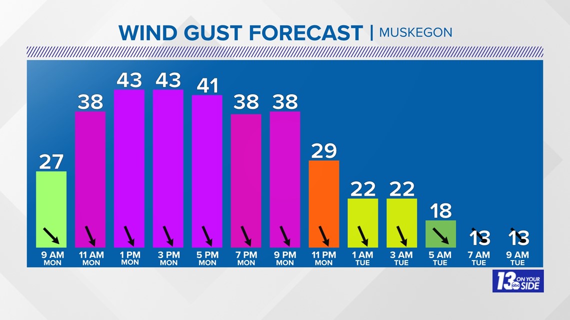
The other factor that will be felt across West Michigan throughout Monday is the blustery winds. Sustained northwest winds of 20-30 mph will gust more than 40 mph at times, potentially as high as 50 mph along the immediate lakeshore. This will create whiteout conditions, even in areas that don’t pick up much snow. Power outages are possible as well.

Despite the brief return to winter, a mild forecast takes over once again as the week goes on. Much, if not all, of the snow will quickly melt away. A white Christmas remains very unlikely as temperatures soar well into the 40s to near 50° by the holiday.
Stay with the 13 On Your Side Weather Team for the latest forecast and alerts as this blast of winter weather passes through.
Have a 30-second video or still photo to share? We'd love to share it with everyone! Email your image to Weather@13OnYourSide.com or post it to our 13OnYourSide Facebook Page.
►Make it easy to keep up to date with more stories like this. Download the 13 ON YOUR SIDE app now.
Have a news tip? Email news@13onyourside.com, visit our Facebook page or Twitter. Subscribe to our YouTube channel.