GRAND RAPIDS, Mich. — After several rounds of light to moderate snowfall came through West Michigan for the last week of 2021, the biggest yet of the winter season is continuing into the second day of 2022!
Some isolated to scattered light wintry mix started around noon for some in West Michigan, with a quick transition to snow spreading over the region soon after.
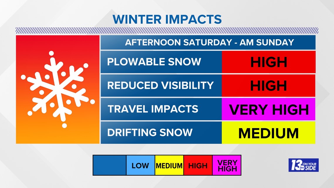
The snow that has been falling since the early afternoon Saturday for some is expected to continue through Sunday morning before tapering off to just lake-effect driven snowfall Sunday afternoon and Sunday night.
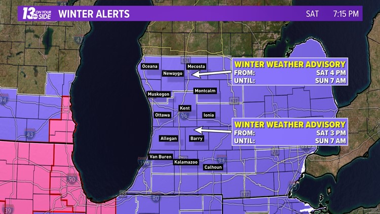
As a result of this prolonged period of moderate to at times heavy snowfall, all of West Michigan will be under a Winter Weather Advisory from now through Sunday morning. You can see details in the image below.


This snow is expected to cause some decent impacts to travel and will fall wet and heavy across the region. Winds will be blowing around 10-20 mph with some gusts that could go over 20 mph. This will result in some drifting snow across West Michigan and wind chills that fall into the single digits.
Adding extra travel time to any trip through Sunday morning will be a necessity.


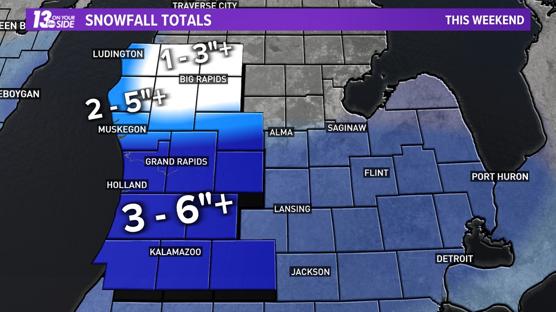
When it comes to snowfall totals, these can still move in terms of their exact placement. These kinds of systems have a tendency to wobble a bit north and south in each model run and will usually contain both light and heavy bands embedded in the overall area of snowfall. As a result, pinning down the exact total for any one spot can be challenging.
Based on the current data we are forecasting the snow totals in the image below for West Michigan.


13 On Your Side will work to keep you updated all weekend long as this system moves through. Make sure to allow extra travel time and stay safe out there!
-- Meteorologist Michael Behrens
Follow me on social media! Facebook Meteorologist Michael Behrens, Twitter @MikeBehrensWX, and Instagram @MikeBehrensWX.
Email me at: MBehrens@13OnYourSide.com
Have a 30-second video or still photo to share? We'd love to share it with everyone! Email your image to Weather@13OnYourSide.com or post it to our 13OnYourSide Facebook Page.
►Make it easy to keep up to date with more stories like this. Download the 13 ON YOUR SIDE app now.
Have a news tip? Email news@13onyourside.com, visit our Facebook page or Twitter. Subscribe to our YouTube channel.


