

GRAND RAPIDS, Mich. — To say the snowy season here in West Michigan is off to a quiet start would be an understatement, but that is about to change for portions of West Michigan! As of Sunday night a wave of energy was heading toward West Michigan that will be amplified with strong winds traveling over Lake Michigan to dump potentially over half a foot on parts of the region.
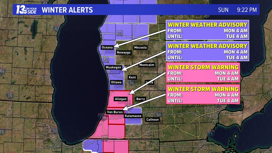
As of 9:20 pm on Sunday Oceana, Muskegon, Ottawa, and Kalamazoo Counties were expected to go under a Winter Weather Advisory at 4 am Monday through 4 am Tuesday. This was increased to a Winter Storm Warning for Van Buren and Allegan Counties.

Scattered showers that were in place through most of Sunday will start to mix with snowfall overnight. Conditions are expected to become entirely snow driven by sunrise across West Michigan.
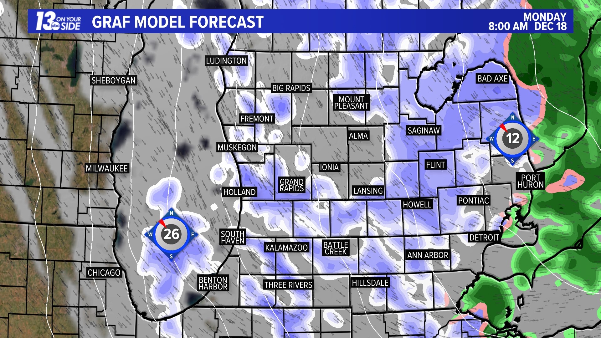
Snow will be most widespread around West Michigan on Monday morning as this wave of energy passes through. Morning commuters should watch out for slick conditions and areas of very low visibility, potentially whiteout at times with the winds.
That round of snow will not produce the heaviest accumulation however. Following the widespread morning snowfall, heavy and intense bands of lake-effect snow will set up, with impacts being felt most along the lakeshore, especially south of Holland.
These bands will continue through early Tuesday morning, combining with winds that could gust over 40 mph, to create hazardous travel conditions. Expect slow going, and possible whiteout conditions, along US-31 north of Muskegon, US-131 north of Reed City, I-94 west of Kalamazoo, and I-196 south of Holland.
Below is the latest hour-by-hour forecast!
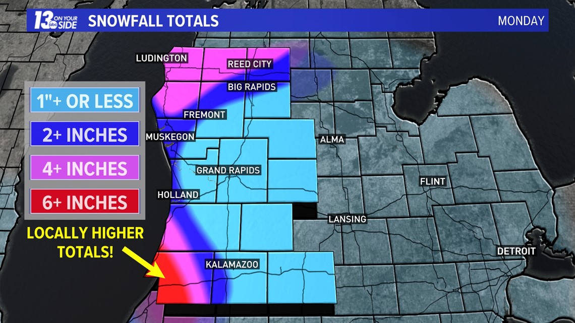
When it comes to snowfall totals, it's no shock that the areas under winter storm warnings are expecting the most. Below is a map of our current forecast, with some areas expected to see up over half a foot of snowfall!

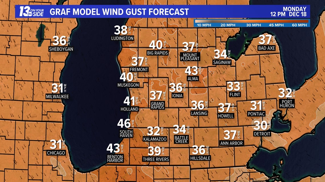
The other factor we've been alluding to in this story are the winds on Monday. Winds are going to play a big roll on Monday, especially with the chances for whiteouts across the region.
Expect wind gusts over 30 to 40 mph throughout the day on Monday.

While this may be a brief return to winter, temps will warm well above freezing over the next week and a white Christmas remains very unlikely here in West Michigan!
Make sure you stay with the 13 On Your Side Weather Team for the latest forecast and alerts as this storm passes through!
-- Meteorologist Michael Behrens
Follow me on social media! Facebook Meteorologist Michael Behrens, X/Twitter @MikeBehrensWX, and Instagram/Threads @MikeBehrensWX.
Email me at: MBehrens@13OnYourSide.com
Have a 30-second video or still photo to share? We'd love to share it with everyone! Email your image to Weather@13OnYourSide.com or post it to our 13OnYourSide Facebook Page.
►Make it easy to keep up to date with more stories like this. Download the 13 ON YOUR SIDE app now.
Have a news tip? Email news@13onyourside.com, visit our Facebook page or X/Twitter. Subscribe to our YouTube channel.