GRAND RAPIDS, Mich. — After a warm end to the weekend in West Michigan, and a mild forecast start to the week, wintry weather will be returning Monday night.
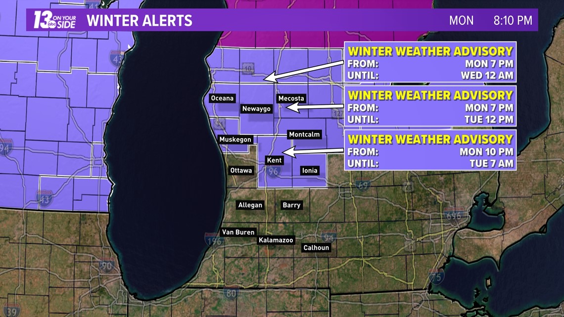
As of Monday night Oceana, Newaygo, Muskegon, Kent, Ionia, Montcalm, and Mecosta counties were under a Winter Weather Advisory ahead of a system arriving Monday night into the day on Tuesday. The system is expected to bring a broad area of wintry mix, rain, and snow to West Michigan, with the highest impacts expected north of I-96.
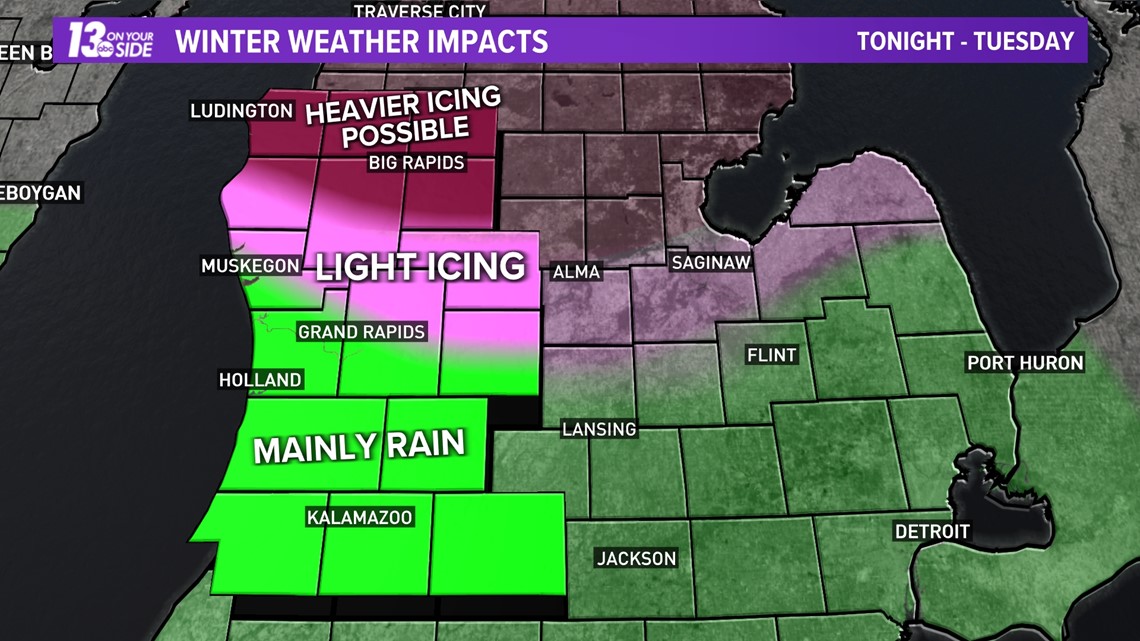
Areas north of I-96 could see several tenths of an inch of ice accumulate from prolonged sleet and freezing rain. This may result in hazardous travel, power outages, and falling tree limbs.
Conditions will worsen as you travel to the north. Even heavier ice accumulation is possible near Traverse City and Cadillac where an Ice Storm Warning is in place as of Monday evening.

With ice in the forecast it could end up being a messy Tuesday morning for areas north of I-96. As a result, this region could be looking at school delays and or closings.

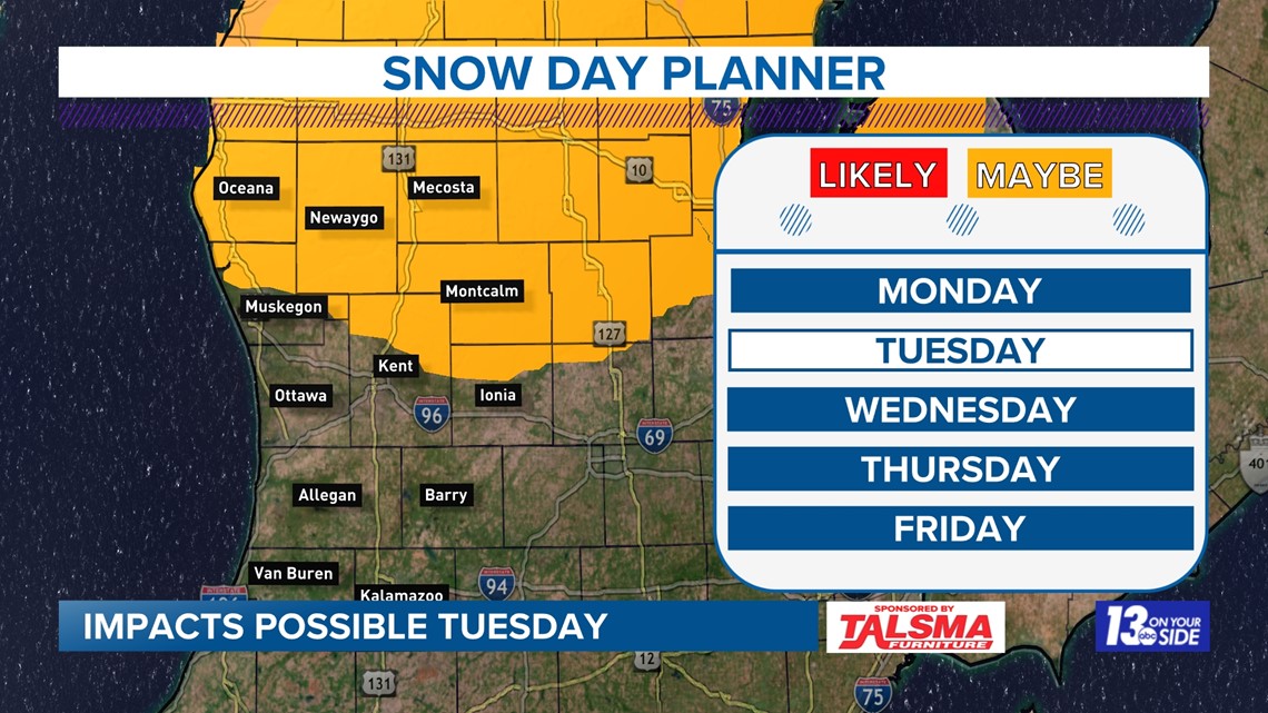
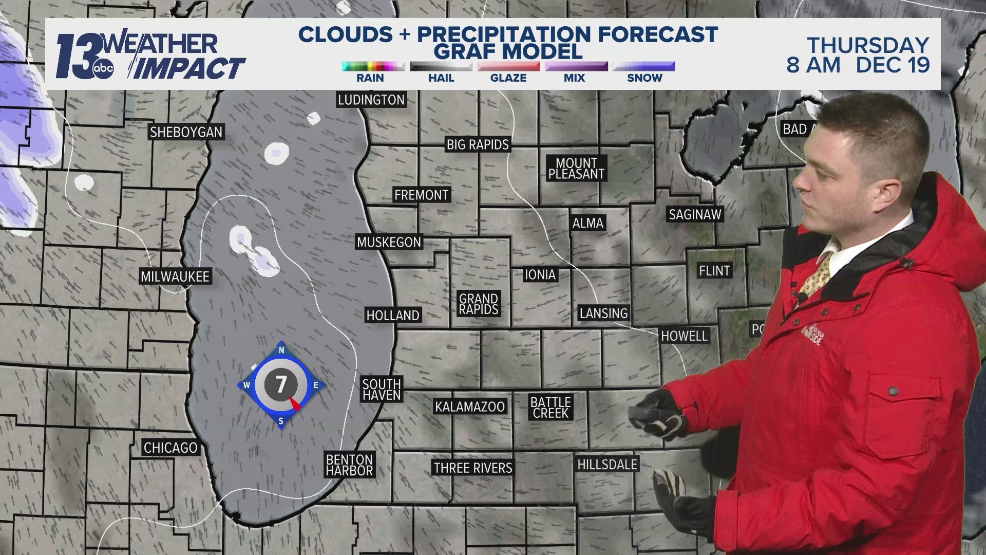
Weather models continue to show persistent, heavy at times, wintry mix around West Michigan starting Monday night and lasting through Tuesday. This mix will likely lead to ice accumulation for some, especially north of I-96. Models vary as to the degree and location of the ice potential, but all models include the risk for wintry mix in our region Monday night through Tuesday.

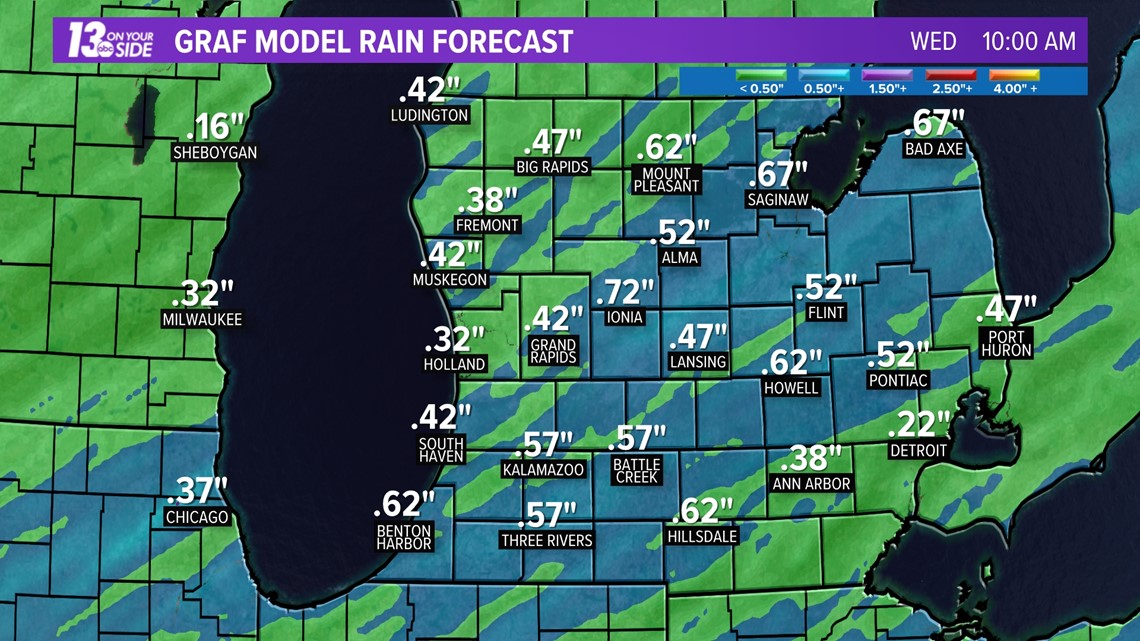
In addition to this wintry weather, rainfall totals around 1/2 inch are also possible with this system. This rainfall will likely add to our already elevated river levels and prolong the risk for minor flooding around the region.

We will continue to keep a close eye on this system as it moves through, so make sure you stick with 13 On Your Side for the very latest!
-- Meteorologist Michael Behrens
Follow me on social media! Facebook Meteorologist Michael Behrens, Twitter @MikeBehrensWX, and Instagram @MikeBehrensWX.
Email me at: MBehrens@13OnYourSide.com
Have a 30-second video or still photo to share? We'd love to share it with everyone! Email your image to Weather@13OnYourSide.com or post it to our 13OnYourSide Facebook Page.
►Make it easy to keep up to date with more stories like this. Download the 13 ON YOUR SIDE app now.
Have a news tip? Email news@13onyourside.com, visit our Facebook page or Twitter. Subscribe to our YouTube channel.